

Vernon Township Map
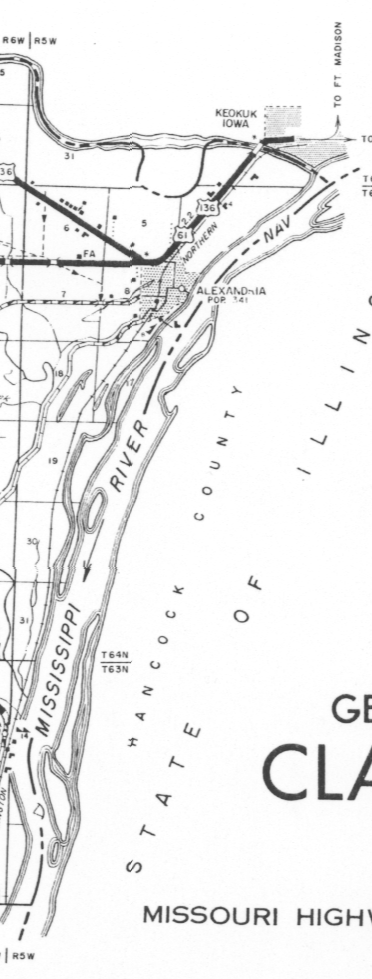
Vernon Township is made up of Southern parts of Section 31, 30 and 29 of Township 65 North Range 5 West, Western parts of section 4, 9, 17, 19, 20, 30, 31, and all of sections 5, 6, 7, 18 of Township 64 North Range 5 West, western parts of section 6, 7, 18 of Township 63 North range 5 West for a total of 8 + square miles.
General Information about Vernon Township
Cemetery
| Cemetery Name | Latitude | Longitude | Section |
|---|---|---|---|
| Alexandria Cemetery | 40 21 ??N | 091 27 ??W | S 8 T64N R5W |
| Note: Most graves were moved to Oak Hill addition around 1925, and other cemetery | |||
Populated Place
| City, Town, or Village Name | Latitude D.d | Longitude D.d | Section |
|---|---|---|---|
| Alexandria | 40.359444N | -091.455278W | S 4 T64N R5W, S 8 T64N R5W, S 9 T64N R5W |
Schools
| School Name | Latitude D.d | Longitude D.d | Section |
|---|---|---|---|
| Alexandria College | Unknown | Unknown | most likely in City of Alexandria |
| Lingle School | 40.359722N | -091.456667W | S 6 T64N R5W |